


Hungary’s 4iG targets wind, SMR investments in CEE, Balkans
12 hours ago
Western Europe faces two days of severe thunderstorms, with supercells, very large hail and even tornadoes possible, as cooler temperatures arrive that will squeeze moisture built up over a record hot summer and could drive a season of deluges and flooding.
A strong jet stream running over the region is generating significant vertical wind shear, and combined with sufficient instability and moisture it has set up favourable conditions for well-organised storms, the forecaster Ventusky said on August 27. The highest risk covers France, Switzerland, Belgium and western Germany, where the shear is strongest.
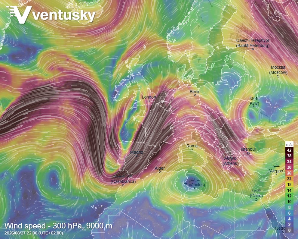
Wind speed at the 300 hPa level, about 9,000 metres, for 22:00 CEST on 27 August 2026. The dark ribbon running from the Atlantic across Iberia and into central Europe is the jet core driving the shear. Source: Ventusky.
Wind shear is turns an ordinary summer downpour into something that damages property. It tilts a storm so its updraught and downdraught stop cancelling each other out, which is what lets a supercell keep going for hours, grow hail to a destructive size and, occasionally, put down a tornado.
And it has already started. Storms, heavy rain, and windshield-smashing hail left thousands of drivers stranded across France on August 27 around Paris. Luxembourg was largely spared the severe weather events that had been forecast, while Paris was hit by powerful storms and torrential rain in the evening. Trees were brought down onto roads, cellars were flooded, and in several cities parks were closed as a precaution. Germany’s national weather service has issued a warning for potentially severe thunderstorms on August 28, with the southeast of Bavaria expected to be particularly affected.
For the insurance market the changing patterns of rainfall that is now part of the annual disaster season is becoming increasingly expensive. Hail and convective windstorm losses have been running ahead of flood in several recent European seasons. The corridor at risk runs through some of the densest industrial and vineyard land on the continent.
At the same time the hottest summer on record has driven up air conditioning demand across southern and western Europe that has been pulling gas away from storage. Several countries, including France, have been forced to shut their nuclear fleet down, cutting output on heat and hydro generation across the continent.
The IntelliNews PRO service includes access to reports, exclusive market data, and more news that decision-makers care about. Stay ahead of the market with IntelliNews PRO.
Sign Up Now


